Introduction
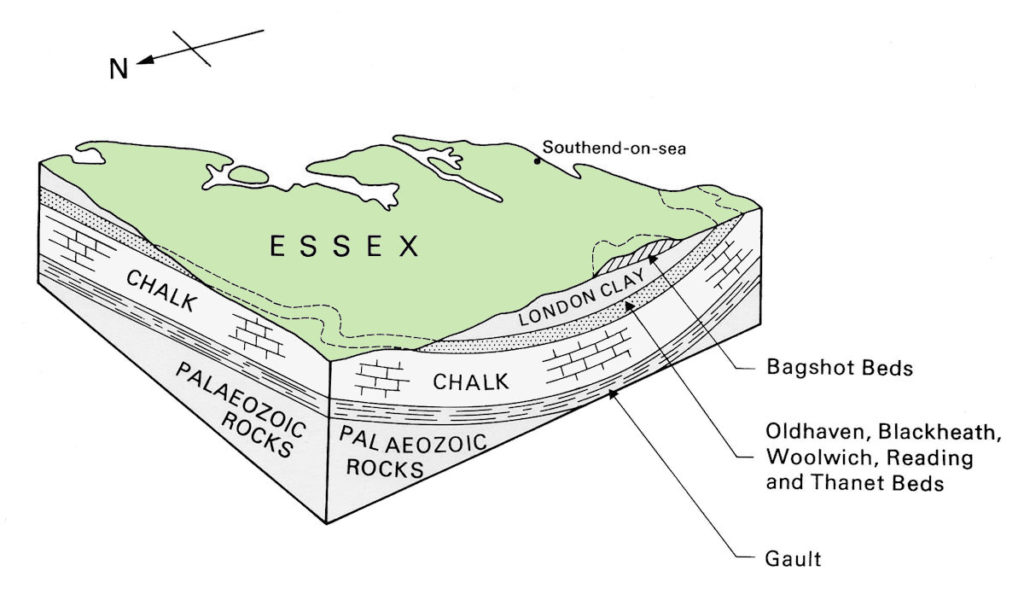
Compared to most other parts of Britain the rocks of Essex and adjoining counties are young in geological terms. Even the oldest surface rock in Essex (the Chalk) is only about 80 million years old. Much older rocks are, however, present at depth (see ‘The Basement of Essex’). We have some idea about these ancient rocks because of the records of boreholes that have been sunk in search of coal and oil.
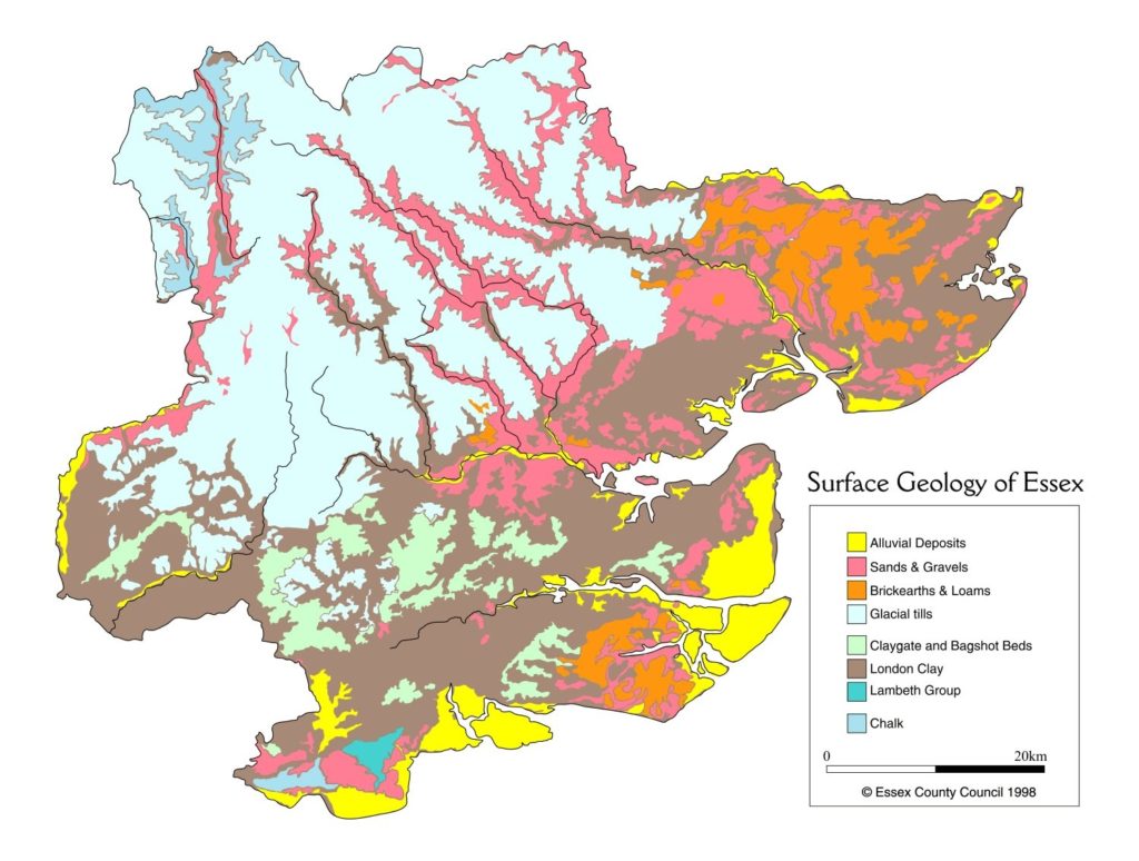
The surface rocks of Essex that were formed before the Ice Age (from the Chalk to the Red Crag) are described as the ‘bedrock’ or ‘solid’ geology. Much of this bedrock geology is concealed beneath the deposits left behind by glaciers and rivers during the Ice Age. The material laid down during the Ice Age is known as ‘Superficial’ or ‘drift’ deposits.
For a geological timescale click here
For a summary of the main geological formations in Essex click here
For details of specific time periods in Essex geological history, click the links below:
Basement of Essex ▪ The Chalk
Thanet Sand to Harwich Formation
London Clay & Bagshot Sand
The Red Crag ▪ The Early Ice Age
The Arrival of Humans
Formation of the Modern Landscape
Geology in Essex Walls
Materials used in thousands of walls around Essex, especially church walls, may often reflect the underlying geology. Blocks and cobbles of building material were dug from local pits, cleared from the land or transported up rivers from seashores. The Essex Rock & Mineral Society are undertaking a project that should enable us to test whether there is a pattern of building that reflects Essex geology. For more information & guidance on how to join in our survey please visit the ERMS website Walls Survey section.