Maldon
The following sites have been selected to represent the different aspects of geology and landscape in the district. Not all sites have something to see; many are solely of historical interest as a record of an important or interesting discovery.
Some sites are not strictly geological but have a geological connection. Geological sites are therefore defined in their widest sense and include, for example, buildings, walls, wells, spas, springs, graves, boreholes, plaques, landslips and viewpoints.
For completeness it includes geological SSSIs but these sites are statutory sites and do not form part of this report. This is not a complete list of geological sites in the district. Others will be added and descriptions expanded as further research is carried out.
Important note:
Not all of the sites here described are accessible. Some sites are on private land and can only be viewed from footpaths that pass through or alongside the site. Inclusion of a site on this list does not, therefore, imply any right of access. Please remember not to trespass on private land.
Sites of Special Scientific Interest (SSSIs)
The Cliff SSSI, Althorne (TQ 922 976)
Also known as Butts Cliff this is one of the most important London Clay sites in Britain. A cliff on the outer bend of the River Crouch near Burnham-on-Crouch is being eroded and London Clay fossils can be found in the beach shingle below the cliff. The site has yielded fossil bird bones (including two type specimens) and is of considerable value in expanding the limited knowledge of small Eocene birds species and avian evolution. The site also yields numerous fossil fish remains (mostly as shark teeth) and crustacea. It is the type locality for several fish species and a crab. There has been extensive collecting since the site was first discovered in the early 1970s and it has yielded a remarkable fossil fauna. Finding fossils at Althorne today, however, requires good eyesight and a lot of patience. Transparent crystals of selenite (a variety of gypsum) can also occasionally be found.
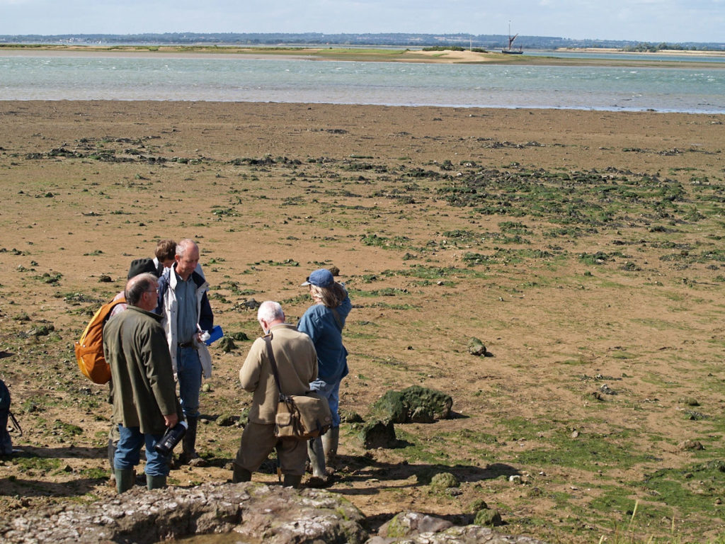
Dengie Marsh, includes Sales Point Cockle Spit (part of Dengie SSSI), Bradwell-on-Sea (TM 035 081(entry point))
Along this section of coast, between the salt marshes and the upper tidal flats there are large ridges composed almost entirely of cockle shells known as ‘chenier’ ridges. Up to 3 metres high and 25 metres long, they result from the erosion of the tidal flats by waves winnowing away at the finer sediment to expose the shells. The area is a nature reserve administered by the Essex Wildlife Trust and is accessible at all times. Parking is available at Eastlands Farm. Enter the reserve via the Saxon chapel of St. Peter-on-the-Wall, walk northwards along the sea wall to Sales Point then south along the beach. Please keep to the sea wall during the shorebirds breeding season between April and August inclusive.
Lofts Farm Pit SSSI, Maldon (TL 866 092)
The Blackwater terrace gravel in this area has produced some remarkable fossils dating from the (Devensian) last glacial stage, about 20,000 years ago – one of the coldest periods of the Ice Age. In the early 1980s a layer of peat in the former Lofts Farm Pit yielded a cold-climate mammalian fauna with bones of reindeer, woolly mammoth, woolly rhinoceros, hyaena, bison and wolf. The finds included the tusk of a mammoth. As a result of this discovery the site of Lofts Farm Pit is now designated as a geological Site of Special Scientific Interest (SSSI). The site is now restored and no geology is visible, but the former pit (now a lake) can be viewed from the adjacent footpath. Private land.
Maldon Railway Cutting SSSI (TQ 842 067)
This former railway cutting (now the Maldon by-pass) is of considerable importance in the Pleistocene (Ice Age) sequence in Essex. The sequence of strata here comprises glacial till, overlain by gravel and silt. The first of these has been termed Maldon Till, for which this is the ‘type site’, and a complex glacial stratigraphy has been set up on the basis of the succession at this locality. No geology is currently visible as the sides of the cutting are covered with trees.
Maylandsea Foreshore (part of the Blackwater Estuary SSSI) (TQ 907 035)
The foreshore on the east bank of Lawling Creek, north of Maylandsea, has yielded large numbers of London Clay fossils, particularly crustacean remains. The SSSI citation states that this section of ‘soft rock’ coastline is of national geological importance. The site demonstrates the maximum transgressive extent of the London Clay, and contains a deeper-water fish fauna than is found at the Isle of Sheppey in Kent. These sediments make up the deepest water facies known in the London Clay and the assemblage of fossils reflects this, with species which are not seen at Sheppey or other sites.
Goldsands Road Pit SSSI, Southminster (TQ 961991)
Goldsands Road Pit provides a valuable section in the “East Essex Gravels”. The gravels here were deposited by the Thames-Medway, a river formed by the confluence in the Southend area of the Lower Thames and Medway, which flowed north-eastwards across eastern Essex. Deposits of gravel to the west that occur at a greater elevation are of Medway origin and predate the confluence of the two rivers. This gravel (known as Southminster Gravel) provides the earliest proof for the presence of the Thames in the area, and that it is of late Anglian age (about 400,000 years old). Private land with permission to visit required from the quarry operator.
Local Geological Sites (LoGS)
Click the links below to read and download the district report and LoGS citations for Maldon District Council.
Maldon District Council – Report on Local Geological Sites – August 2025
MaG1 – Asheldham Pit – downgraded to general geological site.
MaG2 – Chantry Wood Boulder, Wickham Bishops
Large sarsen boulder in private woodland.
MaG3 – Goldhanger Village Well
The village pump is a rare example of a wheel pump, 25 metres deep with a further 35 metres of ‘artesian bore’. This total depth would take the well and borehole through the mostly impervious London Clay and Lower London Tertiaries into the water-bearing Chalk. The pump is a listed building.
MaG4 – Jubilee Recreation Ground, Great Totham
Former gravel pit, now a recreation ground in centre of Great Totham. Steep banks with gravel exposures laid down about 450,000 years as outwash from a glacier that was halted by the high ground of Wickham Bishops, Braxted and Tiptree.
MaG5 – St. Giles Leper Hospital, Maldon
12th century Grade 1 listed ruin of Leper Hospital chapel, built of an interesting patchwork of rock types including locally sourced erractics.
MaG6 – Steeple Bay Foreshore, Steeple
Extensive foreshore area that has yielded large numbers of London Clay fossils, particularly crustacean remains, such as lobsters and crabs.
MaG7 – West Maldon Landslip, Maldon
Classic rotational London Clay landslip on the steep ground on the south bank of the River Chelmer producing characteristic hummocky ground. A public footpath traverses the site. Part of Hilly Fields Local Wildlife Site.
MaG8 – Woodrolfe Creek Saltmarsh, Tollesbury
The best and safest place to view saltmarsh in Essex, with its creeks and tidal flats, is at Tollesbury. Here the marsh is criss-crossed by paths to enable boat owners to reach their vessels.
MaG9 – Stansgate Foreshore, Stansgate
Foreshore area that has yielded London Clay fossils, particularly crustacean remains, such as lobsters and crabs.
Other Sites of Geological Interest
Asheldham Pit (TL 973 017)
The line of flooded gravel pits stretching across the Dengie Peninsula from Burnham-on-Crouch to Bradwell-on-Sea was the route of the northward-flowing Thames-Medway River. One of these pits is Asheldham Pit (a former Essex Wildlife Trust nature reserve) which provides exposures of Asheldham Gravel, laid down by this river about 300,000 years ago. A section for scientific and educational study was excavated by GeoEssex volunteers at the west end of the pit when the reserve was leased to the trust, but this is now totally overgrown. It is now private land with no access possible.
Chapel of St. Peter-on-the-Wall, Bradwell -on-Sea (TM 031 082)
The famous chapel of St. Peter-on-the-Wall was built in 654 AD. It contains a remarkable patchwork of rock types salvaged from other buildings, including the Roman fort which existed on this site. It is a Grade 1 listed building and among the oldest, largely intact, church buildings in England. It is still in regular use as a chapel.
Chigborough Lakes Nature Reserve (TL 877 086)
Essex Wildlife Trust nature reserve consisting of flooded gravel pits. There were formerly exposures of Blackwater terrace gravel and brickearth of the same age (Devensian or last glacial) as Lofts Farm Pit SSSI only 500 metres to the west. (no gravel now visible at Lofts Farm).
Great Braxted Church (TL 585 215)
One of the best churches in Essex for the variety of natural stones in its external fabric. However, access is not always available as the perimeter gate is closed for the majority of the time.
St. Andrew’s Church, Heybridge (TL 855 081)
Church walls with interesting locally sourced stone including London Clay septaria and blocks of ferricrete, probably from quarries at nearby Chigborough.
Northey Island Foreshore (TL 873 059)
Foreshore platform of London Clay on the west side of the island has yielded fossils, but is currently obscured by silt and debris. The island is owned by the National Trust and access is only possible with a permit.
Osea Island Foreshore (TL 904 063)
London Clay fossils can be found on the foreshore at low tide. Stems of fossil crinoids occur in abundance. The island is private property and can only be reached at low tide by a causeway from the mainland.
St. Lawrence and All Saints Church, Steeple (TL 935 030)
Church rebuilt in 1882 reusing material from previous church. A great deal of local cement stone (septaria) was used giving a pleasing effect. Stones were originally collected from the nearby foreshore and some contain fossils.
Clementsgreen Creek Submerged Forest, Stow Maries (TQ 834 965)
A 600 metre (650 yard) section of foreshore reveals fallen tree trunks from a submerged land surface. Possibly over 5,000 years old and dating back to a time when sea level was lower, the Crouch a freshwater river and the coastline much further east. Although many of the trunks have unfortunately been covered by debris from repair work to the sea wall, there are still some to be seen. Part of Crouch and Roach Estuaries SSSI.
St. Margaret’s Church, Woodham Mortimer (TL 822 052)
The parish church of St Margaret’s is a fine example of the use of local septarian nodules for building construction, which are clearly visible in the external walls.