Tendring
The following sites have been selected to represent the different aspects of geology and landscape in the district. Not all sites have something to see; many are solely of historical interest as a record of an important or interesting discovery.
Some sites are not strictly geological but have a geological connection. Geological sites are therefore defined in their widest sense and include, for example, buildings, walls, wells, spas, springs, graves, boreholes, plaques, landslips and viewpoints.
This is not a complete list of geological sites in the district. Others will be added and descriptions expanded as further research is carried out.
Important note:
Not all of the sites here described are accessible. Some sites are on private land and can only be viewed from footpaths that pass through or alongside the site. Inclusion of a site on this list does not, therefore, imply any right of access. Please remember not to trespass on private land.
Sites of Special Scientific Interest (SSSIs)
ARDLEIGH. Ardleigh Gravel Pit SSSI (Martells Quarry) (TM 053 280)
Working quarry revealing Ardleigh Gravel from the early Thames containing beds of organic clay with cold-climate plants and ice wedges. It also contains beds containing temperate plants dating from an unknown interglacial stage about 550,000 years ago. On top of the Ardleigh Gravel is the Martells Gravel deposited by a local river and covered with an ancient warm-climate soil horizon (the Valley Farm Soil) overprinted with a cold climate soil (the Barham Soil). Private land. Permission to visit is required from the quarry owners.
CLACTON. Clacton Cliffs (part of Clacton Cliffs and Foreshore SSSI) (TM 173 143)
The Clacton Cliffs and Foreshore SSSI, as it is known, is a complex series of sediment-filled channels which intersect, but bear no relation to, the present coastline and consist of three separate sites. The two main sites are where the channels were formerly exposed – the cliffs and foreshore at Clacton (TM 173 143), and the foreshore at Lion Point, Jaywick (TM 146 128). The third site is between the two at Clacton Golf Course (TM 156 134). A further site (not part of the SSSI) is the former Butlins holiday camp. Clacton is one of the principal prehistoric sites in Europe and a site of considerable international importance. However, there are no current exposures as the geology now lies beneath the grass, ornamental gardens and beach shingle. The site was discovered by the geologist John Brown in 1830s when the cliffs were still eroding. A channel deposit of the Thames-Medway River about 400,000 years old was then exposed in cliffs yielding bones of lion, rhinoceros and elephant. It is the type site of the famous ‘Clactonian’ flint industry which is based on flint flakes and cores rather than hand-axes. It is also the site of discovery of the tip of a yew spear, one of the oldest wooden artefacts in the world.
HARWICH. Harwich Foreshore SSSI (TM 263 320)
This locality is particularly important as the best exposure of the ‘Harwich Stone Band’, the most distinctive of the ash bands in the Harwich Formation at the base of the London Clay which contains volcanic ash from explosive volcanic eruptions in Scotland during Eocene times some 50 million years ago. The stone band makes this part of the coast the only naturally occurring rocky shore along the entire distance between Norfolk and Kent and may even be the reason for the existence of the Harwich peninsula. The foreshore is also of prime importance for London Clay fossils, particularly for fossil fruits and seeds from the Eocene rainforest. Also found are fossil sharks’ teeth amongst the beach shingle.
HOLLAND-ON-SEA. Holland-on-Sea Cliff SSSI (TM 211 166)
About 450,000 years ago the Thames valley was blocked by ice causing it to alter its course and adopt the route we know today. The gravel in the cliff at Holland-on-Sea dates from just before and just after the Thames was diverted (Lower Holland Gravel and Upper Holland Gravel). Holland-on-Sea lies within the area of confluence of the Thames and the Medway at this time, some 450,000 years ago. Sections of gravel are now obscured by grass and hidden behind beach huts.
LITTLE OAKLEY. Little Oakley Channel SSSI (TM 223 294)
Beneath Little Oakley is Oakley Gravel which is part of the Kesgrave Sands and Gravels, laid down by the pre-diversion Thames at the point where it may have been joined by the early River Medway. Beneath one particular field is a channel cut into this gravel and filled with sediments that contain numerous fossils, including the bones of rhinoceros, giant deer, hyaena and horse. There are also freshwater shells and a fine pollen record, which has enabled geologists to reconstruct the flora and fauna of this distant period of the Ice Age. Although the channel’s exact age is still not known it is thought to be about 575,000 years old. The channel was first discovered during sewer excavations in 1939. In the 1980s a major excavation was undertaken but these trenches were backfilled and there is now no indication on the surface that this strip on the edge of a farm field is one of the most important geological sites in Essex.
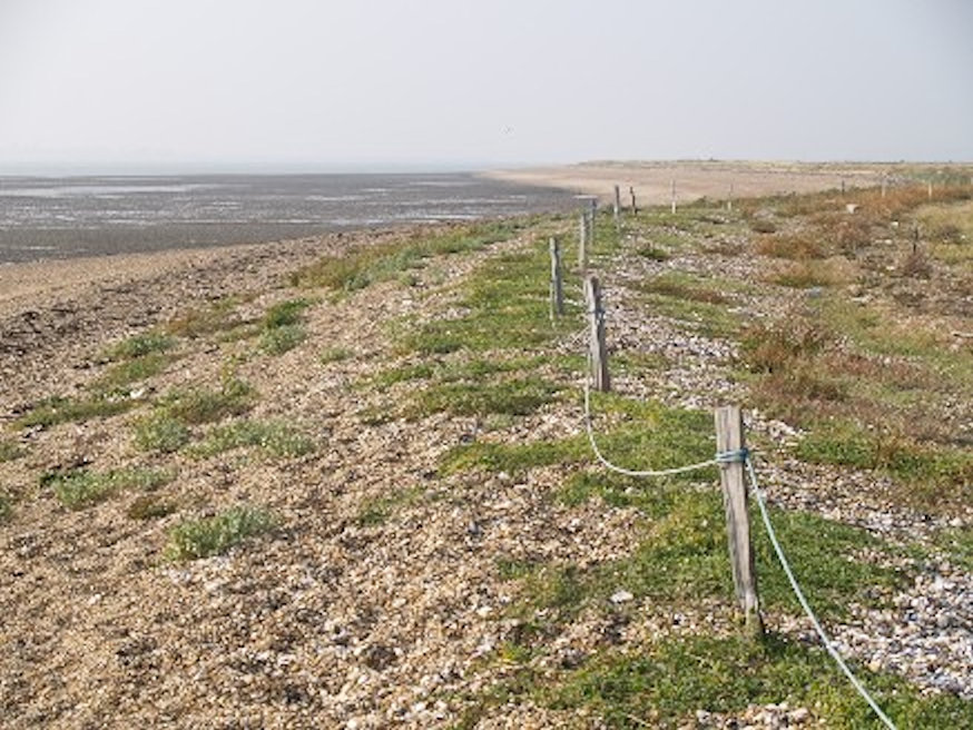
ST. OSYTH. Colne Point Shingle Spit (part of Colne Estuary SSSI) (TM 108 125)
Colne Point is the best example in Essex of a shingle spit. The spit is 4 kilometres (2.5 miles) long and is nearly all that remains of a much larger area that existed in the 19th century but has now mostly been developed by the seaside holiday industry. It is of great interest for studying the movement of shingle and the development of shingle structures. It is an Essex Wildlife Trust reserve. Day permits to visit are available from the Trust.
ST. OSYTH. St. Osyth Gravel Pit SSSI (TM 120 174)
About 450,000 years ago a catastrophic change affected the Thames causing it to alter its course and adopt the route we know today. The deposits at St. Osyth Pit reveal just how rapid the diversion was as the Thames suddenly ceased to flow through central Essex as a result of being blocked upstream in Hertfordshire and west Essex by the Anglian ice sheet. Gravel of the same age is present in the cliff at Holland-on-Sea. St. Osyth lies upstream from the confluence with the Thames and Medway rivers whereas Holland lies within the area of the confluence. The gravel at St. Osyth pit is of two types: the Lower St. Osyth Gravel, which dates from just before the Thames was diverted, and above this is the Upper St. Osyth Gravel which was laid down after the Thames had disappeared from the area. No gravel is currently visible at the SSSI. Permission to visit is required from the land owners.
ST. OSYTH. St. Osyth Marsh (part of Colne Estuary SSSI) (TM 090 144 to TM 130 126)
St. Osyth Marsh is important for studying changes in salt marsh growth and is one of only a few marsh areas in Britain to have been dated (4,300 years).
WALTON-ON-THE-NAZE. The Naze Cliffs SSSI (TM 266 235)
The finest geological site in Essex. Classic cliff section in London Clay, Red Crag, brickearth and Thames Gravel (Cooks Green Gravel). Volcanic ash bands and faults in London Clay. Classic rotational landslips. Diverse fauna of fossils from Red Crag and London Clay. Site of international importance. Geological guide available from GeoEssex.
WRABNESS. Wrabness London Clay Cliffs and Foreshore (part of Stour Estuary SSSI) (TM 172 323)
The London Clay cliffs on the River Stour at Wrabness are the highest vertical cliffs in Essex and consist of the upper part of the Eocene Harwich Formation and the lower few metres of the Walton Member of the London Clay. They provide the best onshore exposure of the Harwich Formation. The Wrabness cliffs are of particular interest because they contain a complete sequence of bands of volcanic ash, which probably originated from volcanoes in Scotland. These ash bands are present from the Harwich Stone Band to the top of the formation. Over 30 separate ash layers occur throughout some 10 metres of clay and silty clay, which was deposited in a subtropical sea about 50 million years ago. The site has also yielded an important fossil flora (preserved in concretions).
Local Geological Sites (LoGS)
Click the links below to read and download the district report and LoGS citations for Tendring District Council.
Tendring District Council – Report on Local Geological Sites – November 2024
TeG1 – Beaumont Red Crag Outlier, Beaumont
An isolated patch, or outlier, of Red Crag, about a quarter of a square mile in size, caps the top of the hill occupied by Beaumont Hall. It is one of the few fragments of a once continuous deposit of Red Crag across north Essex that has been almost entirely destroyed by erosion.
TeG2 – Cockaynes Wood, Alresford
Cockaynes Wood Nature Reserve includes part of the former Villa Quarry, a gravel pit which had exposures of Wivenhoe Gravel. Wivenhoe Gravel, part of the Kesgrave Sands and Gravels, was laid down by the Thames about 500,000 years ago when it flowed across this area before being diverted to its present course by ice during the Anglian glaciation (see separate site entry for Wivenhoe Gravel Pit). It was deposited just upstream of the point where the Thames joined a former course of the River Medway.
TeG3 – Dakings Pit, Thorpe le Soken
A rich assemblage of Palaeolithic artefacts has been recovered from this overgrown pit in the garden of Hillhouse Farm. The deposits are mapped as Cooks Green Gravel (laid down by the Thames-Medway River 600,000 years ago) but it has been suggested that the gravel may be a post-Anglian deposit of the nearby Holland Brook. The pit is historically important; archaeologists such as Leakey, Oakley, Warren and Wymer all carried out research here from 1933 to 1970.
TeG4 – Furze Hill Gravel Pit, Mistley Heath
The disused gravel pit at Furze Hill has a few minor exposures of Waldringfield Gravel, the oldest deposit in Essex from the former course of the River Thames and at least 650,000 years old.
TeG5 – Gants Pit (site of), Dovercourt
Gants Pit in Dovercourt is famous as the richest site for Palaeolithic hand-axes in Essex. It was situated on the west side of the junction of the main Harwich Road and Parkeston Road. The pit ceased working in the 1920s and the site is now levelled and occupied by Spring Meadow Primary School and playing field. A total of 208 hand axes have come from this pit. The mammal bones also found represented species such as beaver, rhinoceros, straight-tusked elephant, fallow deer, red deer and ox (aurochs).
TeG6 – Hill House Sarsen Stone, Ramsey
Sarsen stone about 1 metre (3 feet) tall stands on the roadside by the boundary wall of Hill House. Sarsens are boulders of extremely hard sandstone that occur on the Chalk land surface in Southern England, formed at a time of great warmth, about 55 million years ago, when sandy strata on top of the Chalk was cemented by silca (quartz). This layer was extremely resistant to erosion but it eventually broke up into boulders we now call sarsens. This example may have originated from the Chalk landscape of Kent and brought here by the River Medway.
TeG7 – Mistley Cobble Wall, Mistley
On the south side of Mistley High Street, east of the Post Office, is a brick wall with a section composed entirely of rounded cobbles. Here can be seen numerous ‘exotic’ rock types such as granite, dolerite and gneiss. These rock types are typical of those found in local glacial deposits but the high number of exotic rocks in such a small section of wall is extremely unusual.
TeG8 – Wrabness Brickearth Cliffs and Foreshore
Brickearth dating from an interglacial stage of the Ice Age is exposed in the low cliff and foreshore eastwards from Wrabness sluice to beyond Wrabness Point. The brickearth has yielded bones of elephant and mammoth and has produced these fossils since at least the beginning of the eighteenth century.
Other Sites of Geological Interest
St. Mary’s Church, Ardleigh (TM 053 295)
Ardleigh church has a variety of colour from a diversity of local building materials in an attractive patchwork. The church has a medieval tower and south porch but most of the rest is nineteenth century. The finest craftsmanship is knapped flint flushwork, imported probably from Suffolk but there are numerous erratics, providing geological interest. The erratic cobbles are no doubt from local fields or gravel pits and almost certainly come from the local Ardleigh Gravel, laid down by an ancestor of the Thames about 550,000 years ago. Particularly noticeable are the cobbles of ferricrete, a local iron-rich conglomerate of flint pebbles.
Beaumont Quay Limekiln, Beaumont (TM 190 240)
The circular brick limekiln at Beaumont Quay is the only complete limekiln surviving in Essex. The quay was built in 1832 but the limekiln was almost certainly added later, probably in 1869-70. It was disused by the early 1920s. Limekilns were usually built in chalk quarries to be close to the raw material used for making lime but in coastal areas more permanent and substantial kilns were built in harbours and wharfs where chalk and coal for the kiln could be brought in by sea. Owned by Essex County Council and publicly accessible.
Gravel Wood, Beaumont (TM 162 253)
Gravel Wood is so named because it contains shallow former gravel pits which are now ponds. The gravel is probably Wivenhoe Gravel (deposited on the northern bank of Wivenhoe Gravel Thames). The gravel is currently only visible with difficulty in the stream that runs through the wood. The gravel is overlain by a layer of ‘cover loam’, a sandy, silty clay that covers much of the Tendring peninsula. This cover loam, or loess, is readily visible in the root plates of fallen trees. The wood is owned by Essex County Council and is actively managed as a coppice woodland. It is publicly accessible.
Brightlingsea Copperas Works (site of) (TM 087 161)
The copperas industry is commemorated by road sign for Copperas Road. The copperas industry was an important industry in 18th century Essex. It involved gathering of pyrite nodules (known as ‘copperas stones’) from beaches, where they had been washed out of the London Clay, and then allowing them to oxidise for several months in open vats. This lengthy and hazardous industrial process converted the nodules to ferrous sulphate (green vitriol), which was an essential chemical for making dyes, ink, and several industrial chemicals such as sulphuric acid. Historical site only.
St. Mary’s Church, Great Bentley (TM 108 217)
The parish church of Great Bentley stands on the west side of the largest village green in Essex. The church is unusual as it is largely constructed of ferricrete, an iron-cemented gravel that was quarried locally. This stone, which makes a remarkably durable building material, was formed within local Ice Age gravels as an ‘iron pan’, which can be up to a metre in thickness, at the level of the groundwater table. Ferricrete is one of the few building stones native to Essex.
St. John’s Church, Great Clacton (TM 176 165)
The church of St. John the Baptist at Great Clacton is a local landmark with a short, pyramidal spire. The building has Norman origins and is notable because it is constructed almost entirely from septarian nodules, or ‘septaria’ from the London Clay. These nodules were no doubt collected locally from the foreshore and are one of the few building stones native to Essex.
Beacon Cliff, Harwich (TM 262 317)
In 1704 the naturalist Samuel Dale described a cliff of sand containing fossils at Beacon Cliff, Harwich that appears to be the first record of the East Anglian Crag deposits in the scientific literature. The fossiliferous sand is now known as the Red Crag but unfortunately this exposure, which lay on top of the London Clay, was lost due to coastal erosion in the 19th century. The cliff was illustrated by Dale in 1730. Site also has great historical significance, as it was here that the London Clay nodules were collected for the Harwich Roman Cement industry and the associated discovery of Eocene fossil mammals, including the first discovery in the world of the earliest ancestor of the horse.
The Harwich Borehole (site of) (TM 259 328)
In the early 19th century the lack of good drinking water had long been a complaint among Harwich residents. Following several failures the sinking of an ambitious new borehole was commenced in 1854. In November 1857, three years after the work had commenced, the borehole had been carried through the Chalk, the Upper Greensand and the Gault into the hard, slate-like basement rocks of Essex. Although no satisfactory water supply was obtained from this borehole, and it was to be several more years before a good supply was found for the town, the borehole had reached a depth of over 300 metres (1,000 feet) and proved to be of great value to science. The hard basement rocks of Essex – dating from the Silurian period and about 420 million years old – had been revealed for the first time. The site was by the harbour, near the pier, just west of the former Great Eastern Hotel. An historical site only.
Hamford Water National Nature Reserve, Kirby le Soken (TM 267 238 approx) Hamford Water is a large, shallow inlet between Walton-on-the-Naze and Dovercourt with an interesting complex of saltmarsh, sandbanks and tidal creeks. It is unusual as it is similar to an estuary but is only fed by a few small streams and not a major river as elsewhere on the Essex coast. Extensive saltmarsh covers one third of the area. The Hamford Water embayment – a depression in the London Clay bedrock – is filled with marine sediment, and demonstrates the influence of the surrounding geological features on the ‘estuarine’ processes. Normal estuaries on flat lands develop a funnel shape that is controlled by the energy of waves and tides. Hamford Water cannot do that because of the rising ground and the lack of river valleys; it is consequently short and wide.
Soken Wood, Kirby le Soken (TM 220 223)
Soken Wood is a relatively new native broadleaved woodland created in November 2000. Because of the wood’s close proximity to The Naze, which is rich in fossil plants from the London Clay, part of the site has been planted up with exotic species of prehistoric origin. The trees planted are stands of monkey-puzzle and ginkgo, with individual specimens of witch hazel, magnolia, oriental plane, tulip tree and dawn redwood. Soken Wood is owned by The Woodland Trust and is open at all times. There is an information board and parking.
Harmer’s Red Crag pit, Little Oakley (site of)
The existence of shelly Red Crag capping the high ground at Little Oakley has been known since at least the 1860s but it was not until the remarkable work of amateur geologist Frederick Harmer (1835-1923) in the early years of the twentieth century, that the site received any attention. Harmer reopened a shallow pit to the east of the village near Foulton Hall and sieved the sand for fossil shells over a period of several years. The result of these efforts was his two volume work ‘The Pliocene Mollusca of Great Britain’ published in 1919 in which he states that over 600 different species of mollusc were found in this pit (nearly 400 of the species illustrated in the book are from Little Oakley). Harmer’s work has shown the extraordinarily rich molluscan fauna of the Red Crag sea. Harmer records that all of the fossils came from ‘an area of twenty yards square’ and says that they were obtained ‘during many years labour, and by the sifting and examination of something like 200 tons of material’. Harmer’s pit has long ago been filled in but the site is of great historical interest as one of Britain’s most prolific fossil localities.
Copperas Bay and Copperas Wood, Ramsey (TM 199 312)
The copperas industry is commemorated in the name of Copperas Wood and Copperas Bay but information on this industry is lacking in the publicity for Copperas Wood, which is an Essex Wildlife Trust reserve. A copperas works is marked as ‘Copperas House’ on the 1882 geological map (based on an 1838 original plate) and the exact site may have been where Copperas Wood Farm is now situated (TM 204 318).
Priory Gatehouse, St. Osyth (TM 121 157)
Erected in 1481, the battlemented gatehouse of St. Osyth Priory is one of the finest examples in Britain of the use of flint ‘flushwork’. Flushwork is the name given to the technique of setting ‘knapped’ flints (flints skilfully worked to produce a flat face) into a wall, often in intricate patterns alongside another stone such as limestone. St. Osyth Priory is privately owned and no longer open to the public, but the gatehouse can be viewed from the green open space between the gatehouse and the road, where there is also car parking.
Site of Weeley borehole, Weeley (TM 14737 21833)
In the latter part of the 19th century, the discovery of a deep coalfield near Dover stimulated the search for coal in East Anglia. The Eastern Counties Coal Boring and Development Syndicate was formed for this purpose and they sunk a borehole at Weeley in 1896, their previous borehole being at Stutton on the Suffolk side of the Stour estuary. The borehole penetrated the deep Palaeozoic basement rocks at a depth of over 330 metres (1,100 feet) and continued to 372 metres (1,221 feet) before the project was finally abandoned. The basement was found to be Silurian rocks (approx. 420 million years old) and not the younger Carboniferous coal measures that had been hoped for. Directors and shareholders had invested a considerable amount of money in the venture but the syndicate was finally wound up a year or so later.